The dreaded Map fold; why do paper maps still exist?
I’m sitting at the kitchen table here in Vermont with my new friend Steve and Marina who arrived here from Oregon on a cross country motorcycle trip. We’ve got the laptop open to Google Maps and Steve has his paper map unfolded across the table with notes arrows and locations circled.
I remember fondly, my Dad driving the family from New York to Florida and back every summer. Me, I’d be holding the large atlas in my hands trying to figure out where we were, what was coming up, where the next hotel or restaurants might be and any interesting alternate routes around big cities. Sure, today you simply get on I-95 and select the belt ways around each city, but back then I-95 barely existed and you’d be required to exit and re-enter the Highway often by detouring to US-1 and back. To some, this might seem a hassle, but to me, it sparked a desire to discover. Discover new roads, new routes, new scenery.
One thing we never did was head West. Our family vacations, though privileged, were limited to the East Coast. As I go older, the desire to ‘Go West’ grew stronger and stronger. While I eventually flew to LA, flying just didn’t do it for me. It was the road that would be calling me, not the skies.
July 4th 1999 was the year that I  would hit the road in search of adventure. It would happen after I bought and then sold an RV, a Truck and made numerous other poor attempts to go. The vehicle that would carry me on a trip of a lifetime would be a Honda ST1100 that I had picked up a year or two earlier. There I was, my bike, camping gear that I had never used before (I had only camped three days my entire life at that point) and an Atlas. I had no direction, no cell phone, no time limit and no idea what I was doing. It was awesome.
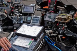
Today, my bike is outfitted with a Smart Phone, Motorcycle Specific GPS, GPS Locator (think of a GPS in reverse. Instead of it telling me where I am, it tells others where I am) and…an Atlas. Why do so many of us still ride and travel with a paper maps?
I first started to use Electronic maps via AOL and Mapquest way back in 2000. When electronic maps were released to the general public, they professed it would be the end of Paper Maps. While boaters were using GPS units, they were warned of its inaccuracy. Auto GPS units hit the market hard once the government turned off the GPS feature that purposely made private GPS’s inaccurate out of fear of missile attacks. Paper Maps were sure to go the way of the Telegraph now, but they didn’t.
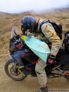
 Ask any rally rider and they will show you two to three GPS units on their bikes. Usually a smart phone AND a paper map or scroll. Electronics always fail and they fail when you need them most so redundancy is required. Paper maps never fail. Paper maps allow you to make notes on them and the number one reason paper maps wont disappear; The Fold.
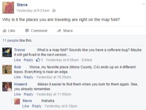
So a day after Steve and Emily take off for Maine, I see a post from him saying, “ why is it the place you want to go is in the map fold?” No one but a paper map user would ever understand that statement, but those of us that do – understand it well. You see, the best places exist in the map folds. In fact, years ago, we would use the map folds to mark destinations. Some towns even touted it on their billboards. Map folds towns are fun, interesting and worth a road trip.
So next time you get ready to hit the road; don’t forget to bring your Atlas.

